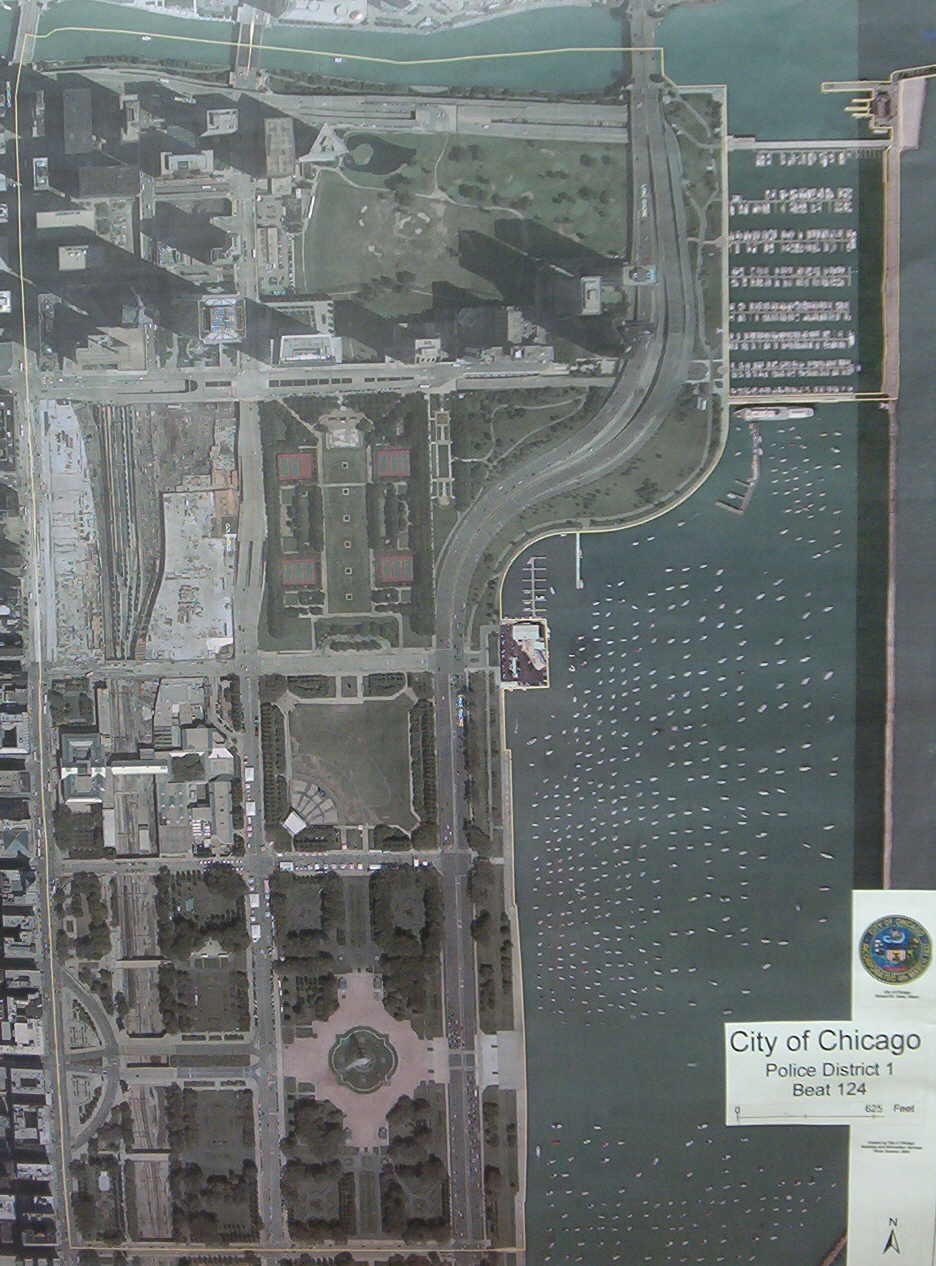
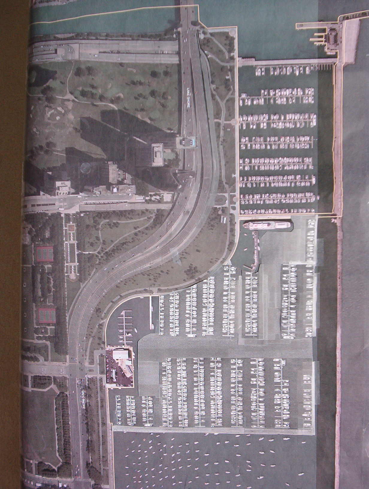
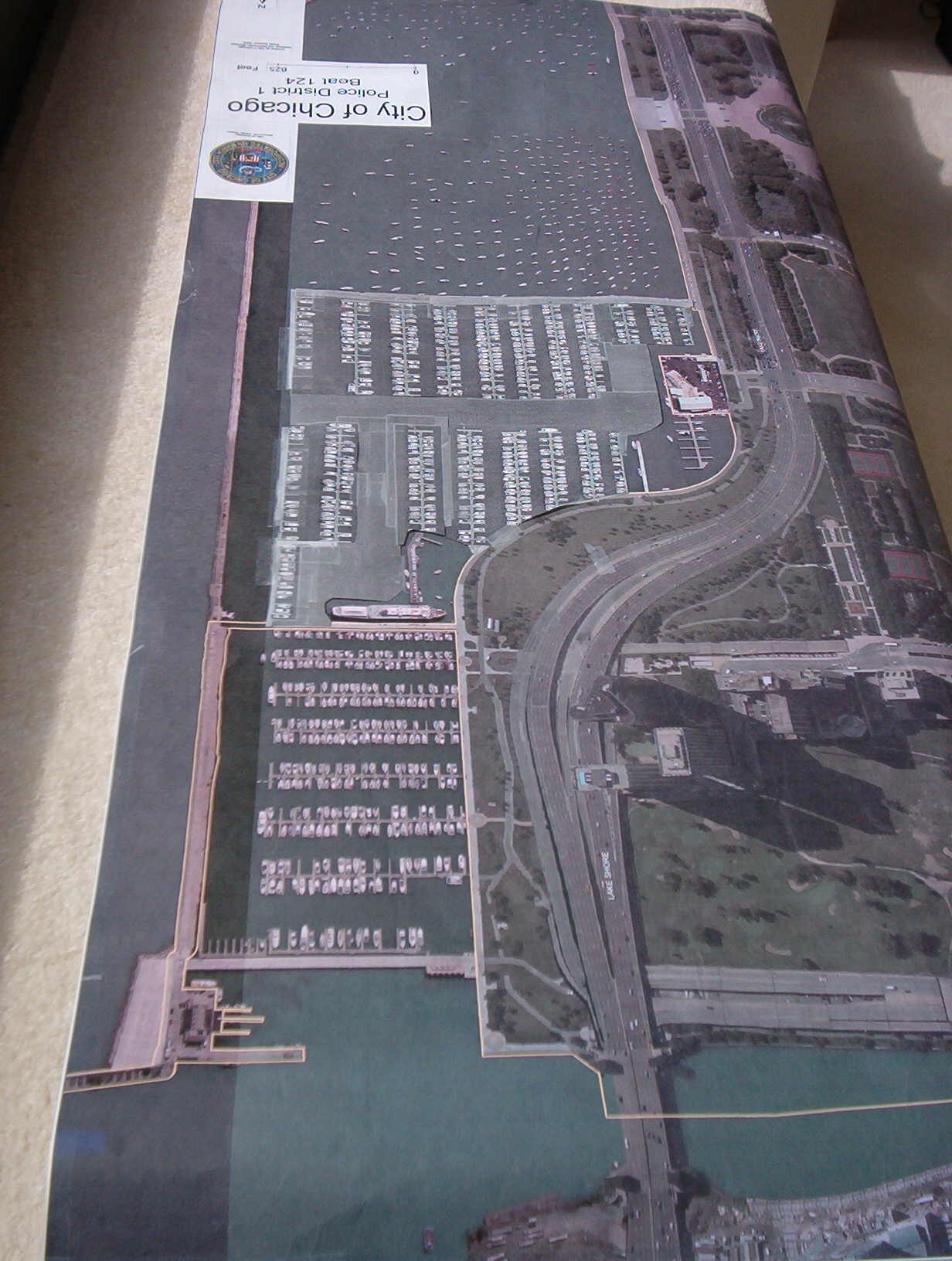
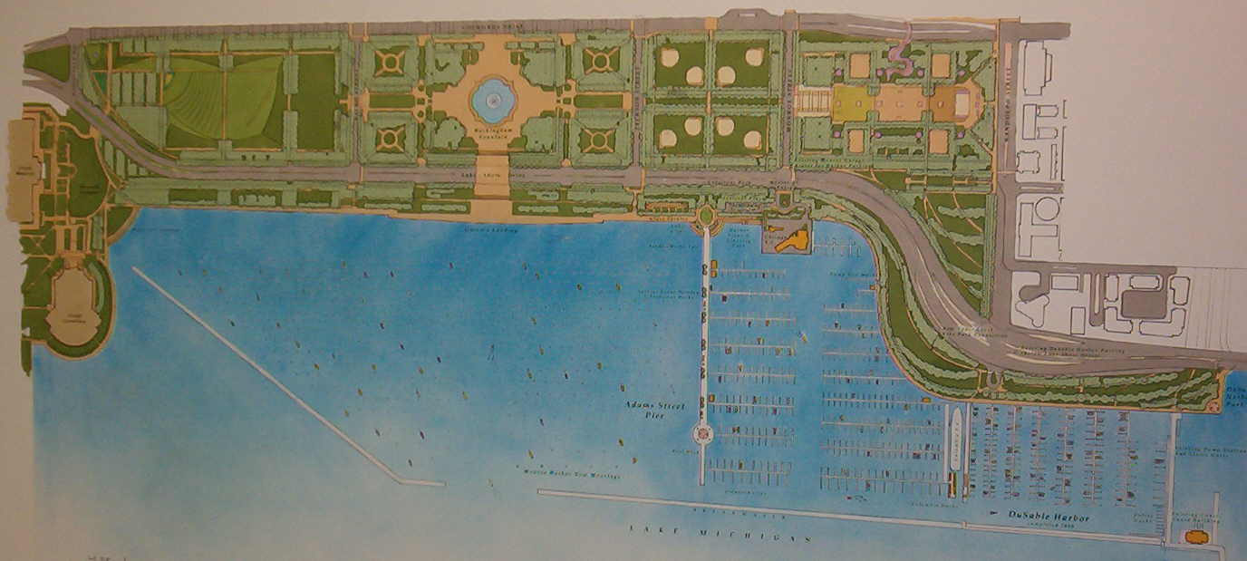
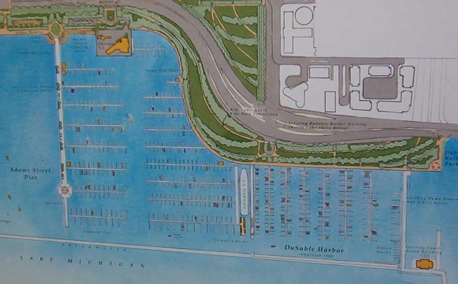
DEPENDING ON THE PUBLIC INPUT, ALL 300 BUOYS NORTH OF THE PROPOSED PIER COULD BE REPLACED BY 900 SLIPS WITH SIMILAR DENSITY TO DU SABLE HARBOR JUST TO THE NORTH.
THE 700 EXISTING BUOYS SOUTH OF THE PROPOSED 1500 FOOT PIER ARE NOT BEING CHANGED IN THIS RENOVATION.
ADAMS
RANDOLPH
MONROE
BUCK.
400
155
175
195
MILLENNIUM PARK (UNDER CONSTRUCTION)
DALEY BICENTENNIAL PLAZA
PEANUT PARK
LAKESHORE EAST (UNDER CONSTRUCTION)
CHICAGO RIVER
DU SABLE HARBOR
AON
BC/BS
WACKER
We will attempt to publish a picture on this webpage that shows the change in your view of Monroe Harbor, if this proposal is approved by the park district and the City of Chicago.
625
Buckingham Fountain
Queen's Landing
This page was last updated on: June 14, 2008
Page Visits
To Index of NewEastside Forum
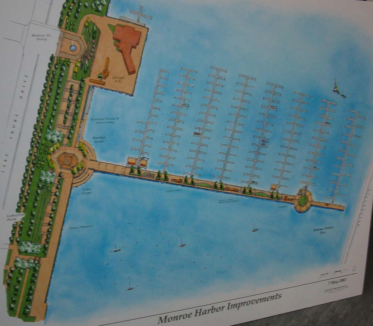
Here is a possible plan based on the text description in newspapers. The actual plan will be added to this website page after the public hearing on Tuesday May 6, 2003 at 6:30 at Daley Bicentennial Fieldhouse.
We merely cut and pasted the same density to create a possible layout of the park district plan which will be available Tuesday evening, May 6, 2003.
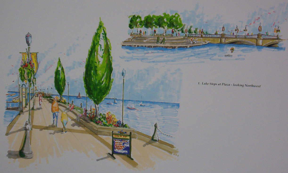
Here is an approximate prospective view that emphasizes the foreground in a similar way that you would experience from your condominium.
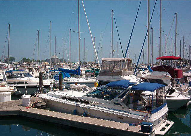
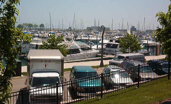
Photos #4 an #5 had previously been taken from Harbor Point of DuSable Harbor when it was only half filled. These substitute next 5 pictures (4A, 4B, 4C, 5A, 5B) are of Burnham Harbor on June 7, 2003 and offer a vivid prediction of the proposed "renovation" of the north third of Monroe Harbor. Note the water is almost completely "obstructed" by the slips and boats.
This area should be left open for the training fleet and to respect the space of the Columbia Yacht Club.
Recommended Open area for the Chicago Yacht Club
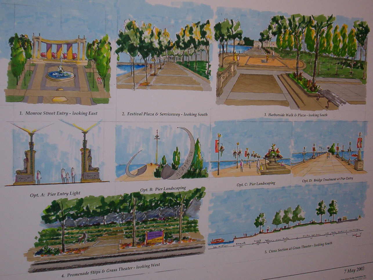
These graphics are 5 photos of the 4 boards presented by the Chicago Park District and their Westrec managers at the May 6, 2003 GPAC meeting.
Pic #1
#2
#3
#4A
#4B
#6
#7
#8
#9
#10
Please note that 98% of the boats are missing from this Westrec/Park District graphic. It is important for the park district consultants to present accurate information, so that helpful feedback can be provided to our representatives.
95% of the 900 boat slips are empty in this Westrec/Park District graphic. This presents a distorted view of the visual impact this plan will have on Chicago's beautiful frontyard harbor.
88% of boats are missing from the existing DuSable Harbor
95% of the boats are missing
88% missing
#4C
#5A
#5B
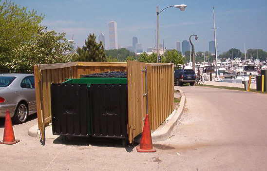
The addition of 600 boats to Monroe Harbor will require additional garbage dumpsters such as this Burnham container. Also more persons live aboard boats in slips as compared to boats on buoys.
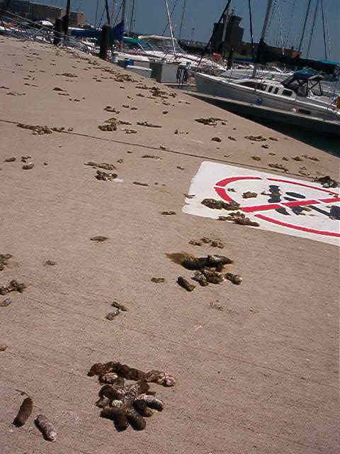
These bird droppings at Burnham may be due to the higher density of boats and available food. The existing lower density and openness of the bouys at Monroe Harbor do not generate a similar health problem.
Meigs Terminal
Adler Dome
Graphics added September 9, 2003
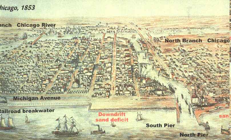
There were "no obstructions" on Chicago's lakefront in 1853 and "no historic core" as the park district is claiming today.
You may desire to share your ideas and opinions with other visitors to this website. We will share your opinions with the park district officials.
Further discussion on the basic dedication restrictions (covenants) and a NEW visual comparison (from the same spot) of the present Monroe Harbor and a photo of DuSable Marina is presented on the next page.
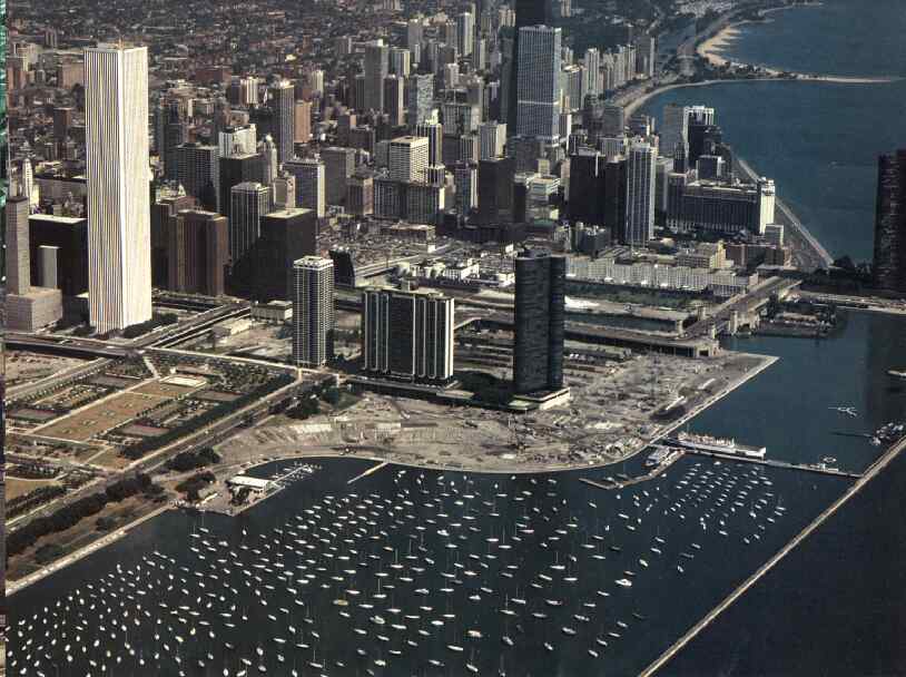
There were "no obstructions" on Chicago's lakefront in 1987 when the Lake Shore Drive curve was constructed and there was "no historic core" according to several historians. The first mention of a "historic core" was invented for the 2002 Grant Park Framework Plan. Possibly the park district planners were anticipating their current justification for the Monroe Marina that the covenants only require that we protect the "historic core". But fortunately for the opponents to the marina, the 24 selected representatives that studied Grant Park and Monroe Harbor for over 18 months with the planners inserted these works in the 2002 Framework Plan, that make it impossible to justify the proposed Monroe Marina:
"Maintain the essential historic character and recreational / boating capacities of Monroe Harbor, unencumbered by additional piers or other barriers. Alterations to the harbor or breakwater should be consistant with the overall character of Grant Park Framework Plan."
The park district now claims that was "just a plan" but no one buys that story.
There should never be "obstructions" on Chicago's lakefront between Randolph and Roosevelt because of the Canal Commissioner's 1836 covenant and the Fort Dearborn 1839 covenant.
In 1836, they inscribed on the lakefront plat,
"Public Ground - A Common to Remain Forever Open, Clear and Free of any Buildings, or Other Obstruction whatever."
These covenants and the related state statues were upheld by four separate Illinois Supreme Court decisions in 1897, 1902, 1909, and 1910.
There have been numerous buildings and obstructions built or proposed in the 167 years since 1836, and none have survived legal challenge and/or public outcry. The proposed 1500 foot permanent pier and 900 permanent slips filled with boats will obstruct the northern third of our historic frontyard and open harbor. According to the Illinois Supreme Court, these historic covenants extend out to the harbor breakwater and have successfully preserved our most valuable asset for the enjoyment of all the citizens of Chicago. These covenants cannot be ignored by either the state, municipal, or local governmental bodies as determined by the Illinois Supreme Court.
Please help in the effort to save our precious frontyard for the future generations of our citizens.